Mapping Victoria’s fake public space
This post is about spaces and agreements that may exclude people from privately-owned 'public' property. All of the land in question is on traditional Lekwungen territory. Regardless of the particulars outlined below, there has already been a displacement of the Lekwungen people from these spaces, both 'public' and 'private.'
England is having a national conversation right now about fake public space, where more and more seemingly public spaces are actually owned by private companies. Those companies have their own rules about what the public can and can’t do while visiting these spaces. As reported by the Guardian, sometimes the owners of these spaces enforce their rules in a discriminatory fashion against homeless people; other companies have used their powers to stop protests.
“To the ordinary person, there’s no distinction between here, and there,” [said a homeless man], pointing first at a public pavement by the taxi [stand], and then at a privately owned road that leads north towards Granary Square. “To me, the difference is everything, because I’m not the sort of person they want over there.”
Leaders of England’s national political parties have raised concerns about the creep of fake public space, and their media and city councils are devoting time to fighting it. That conversation isn’t happening in Victoria, but it should be.
Fake public space in Victoria
Victoria has relied on developers to create the impression that we are a city with plentiful public space. But sometimes the areas that people would think of as public by default — alleyways, open spaces, and sidewalks — are privately owned.
Market Square, listed on a Victoria “Green Map” as “public space,” is owned by Anthem Properties. They’ve put up signs to let you know that hacky sack-ing isn’t welcome there.
One tourist gave Fan Tan Alley a low rating, because he was surprised “a public thoroughfare” was locked until 9:30 am. It’s private property, albeit with a public right-of-way agreement signed by the city. I hope he didn’t hear about the private road behind the “Public Market” at the Hudson, because that might have been too much for one day. Trounce Alley keeps different hours from Fan Tan, but it’s private, too. Dragon Alley, Theatre Alley, most of Odeon Alley, and the alley linking Herald and Chatham are all privately owned.
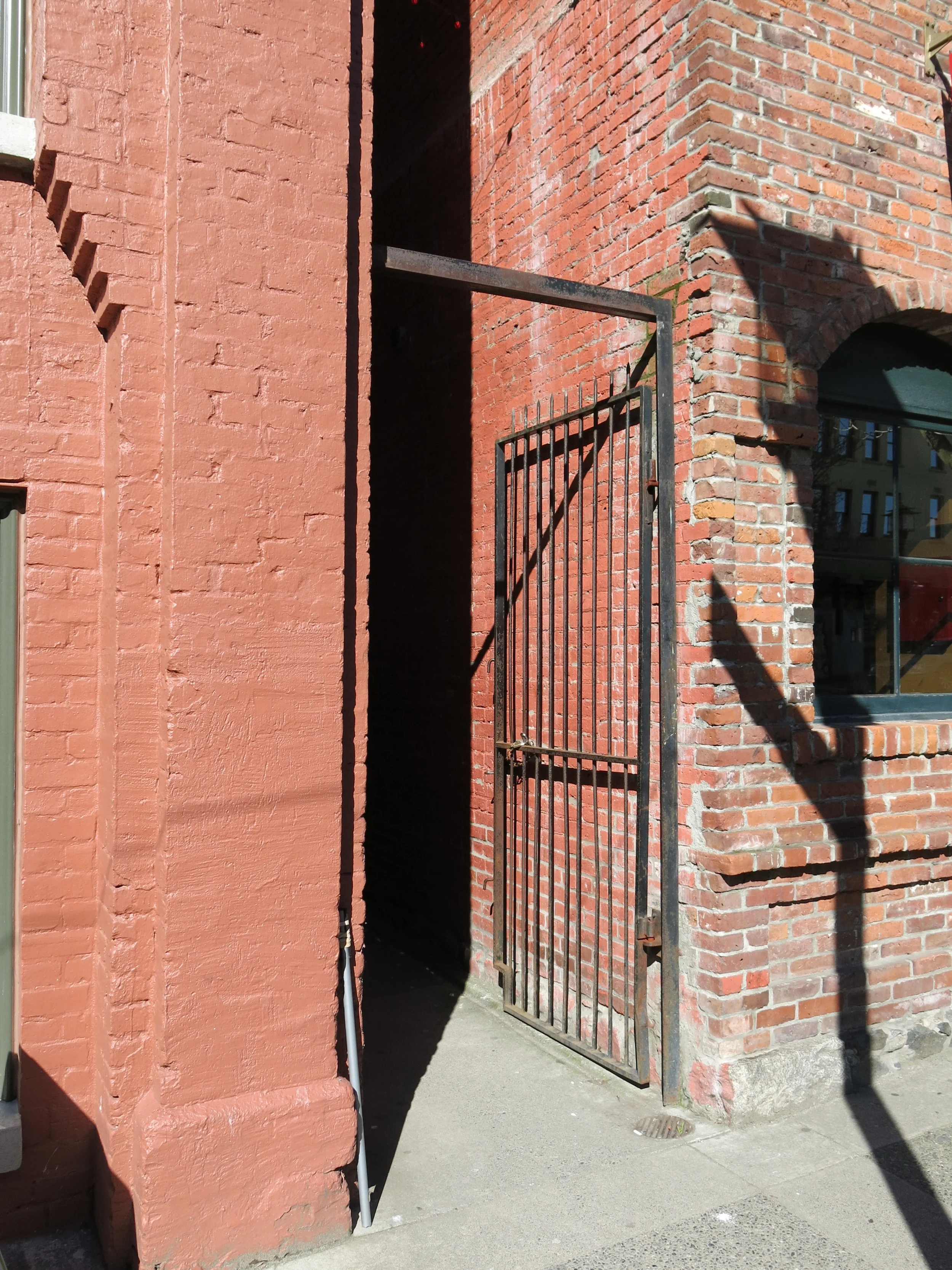
Fan Tan Alley is privately owned, with a city right-of-way.
How about when you’re walking up Government on the sidewalk beside the Empress? Except for a little bit that juts out at the crosswalk, Victoria’s online map suggests the rest of the sidewalk belongs to the hotel. And how many people stop and think about how they’re cutting through private property when they walk past the Emily Carr statue on their way to Douglas Street? The paths and green space are all privately owned.
If you’re walking outside the Atrium on Blanshard on the inner sidewalk, you’re under the Atrium’s rules, while the outer sidewalk is the city’s. People can’t be expected to know where these invisible barriers begin and end, and they can’t be blamed for thinking privately-owned spaces are public when the city has taken great pains to create that illusion.
The map
Victoria’s reliance on developers to provide pseudo-public space is worth a public conversation. To help move that conversation forward, I mapped where some of these invisible barriers have gone up over the years. If you're using a computer, I suggest clicking the top right corner of the map to open it in a new window.
To be included, spaces had to be publicly accessible, uncovered, and privately owned — the Guardian's three-point test for fake public space. Note that the map is far from complete, and it may have problems. Please see the “Methods” section at the bottom of this post for more details.
The map includes two kinds of fake public space:
- Privately-owned, uncovered spaces with a public right-of-way; and
- Privately-owned, uncovered spaces with no right-of-way.
A right-of-way means that a property owner has agreed to let the public access the space, but they still retain private ownership. For example, the city signed a right-of-way agreement at Douglas and Pandora, which says the company can kick people out of their upcoming ‘public’ square for a number of reasons, ranging from disorderly conduct to being unconscious:

Image source: Statutory Right of Way – Douglas Plaza (p. 85; large file size)
The fact that I was able to find the text of this agreement makes it the exception rather than the rule. All of the rights-of-ways agreements downtown may have their own sets of expectations, but they aren’t publicly available.
There are also numerous uncovered spaces that might appear public, but which have no official right-of-way. I’ve included those alleys, squares, and access roads on the map. I’ve even included the ones that post “private property” signs, because property lines are rarely clear, and you’d be forgiven for thinking an alley or square is public space.
While this map is imperfect and incomplete, hopefully it will help to identify some of the barriers created by blurring the lines between public and private.
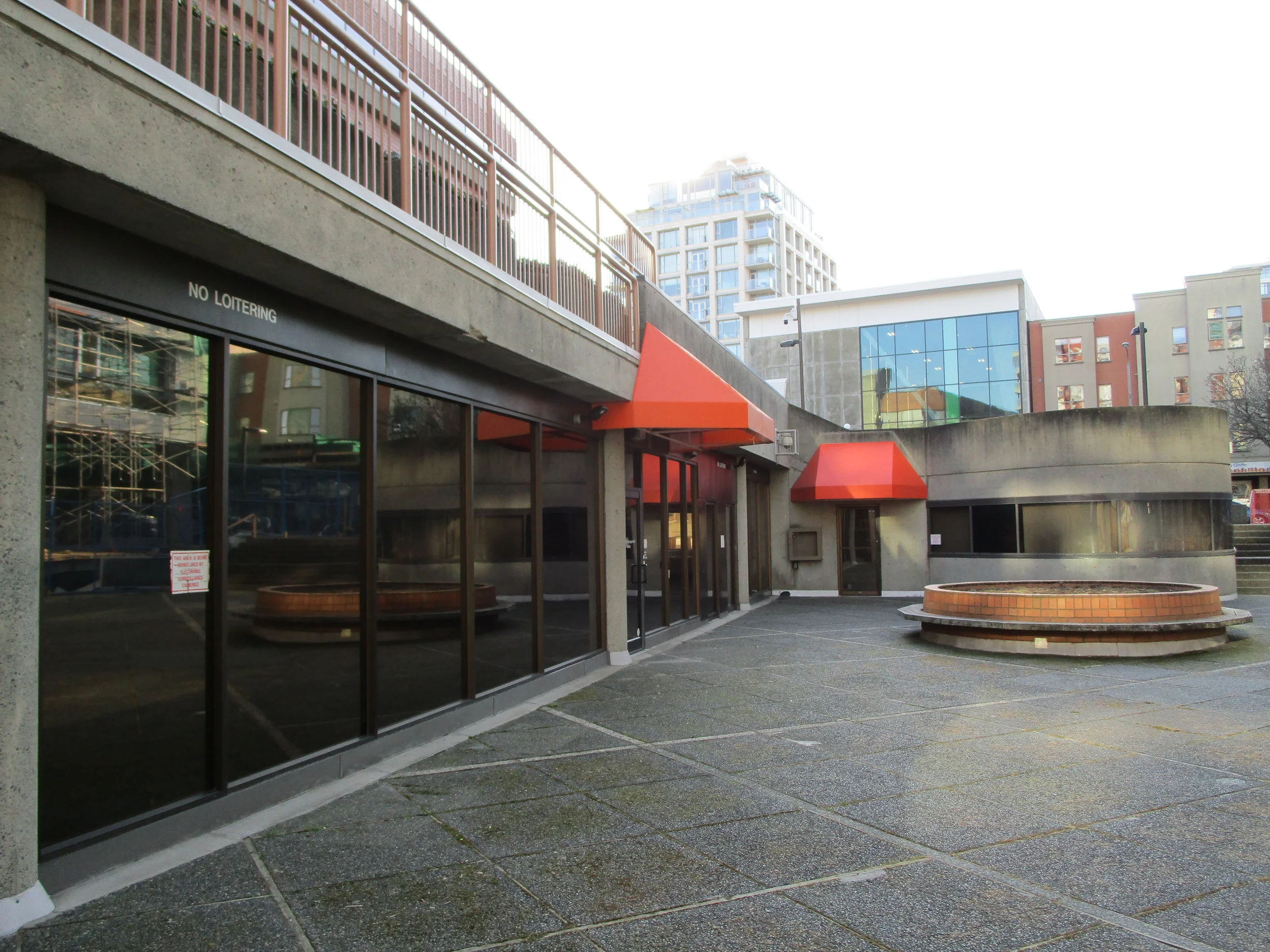
The large square at 1520 Blanshard Street is privately owned.
The city defends fake public space
I found it both surprising and disappointing to learn that there’s no inventory of rights-of-way and privately-owned public space in Victoria. The public should be able to find out what’s public space and what isn’t, but they can’t. People should also be able to quickly see each right-of-way agreement and the rules that apply in any given space, where applicable. And the city should probably know how many of these things they have, and how much of Victoria’s so-called public space is actually privately owned.
In my discussions with city staff, they defended the rights-of-way agreements. “The purpose is primarily to allow public to access space on private property they would not otherwise have access to,” they said. “The terms [of the Douglas and Pandora right of way agreement] are aimed at inappropriate conduct rather than some ‘type’ of persons,” and “the conduct regulated through these clauses … is the same type of conduct that is regulated under City bylaws in relation to public places. In other words, the intent is that … they … function in a manner similar to City streets and other public places.”
Put another way, companies can enforce things in pseudo-public space that bylaw and police officers might enforce if they happened on public property.
I was interested in what the city had to say, but their defence of these agreements reads more like an indictment. First, it’s worth repeating that the U.K. found that similar agreements in London have been used in a discriminatory fashion. Regardless of their intent, they were used to target a “type” of person, to borrow Victoria’s words. Second, there is nothing to celebrate about the fact that Victoria’s bylaws ban things such as kneeling on sidewalks during the day, while also limiting people’s options for sleep and shelter. Allowing private companies to enforce those rules in what people think is city-owned space seems like it would only add to existing harms.
Conclusion
If city council believes that privately-owned public space benefits the city, they should stop and consider just how little they know about the practice in their own town. City staff couldn’t tell me how many rights-of-way there are, or where they’re located. And I didn’t bother asking about the more ambiguous spaces without rights-of-way, which almost certainly aren’t tracked.
I’m not advocating for drawn-on property lines, or for more of the aggressive “private property” signs that dominate the city’s downtown core. I’m simply pointing out that under the system the city has created, without constant access to title documents ($7 each), property plans ($15), the internet, and surveying equipment, it’s impossible for Victorians to know where public space begins and ends, and what rules the city has agreed to let the developer enforce.
Instead of being grateful when companies offer up a few feet of limited access in front of a new building, the city should consider what it means when they sign off on yet another invisible barrier that may disproportionately affect poor and homeless Victorians. The city has agreed to the corporatization of our public spaces, and they have a responsibility to deal with the consequences.
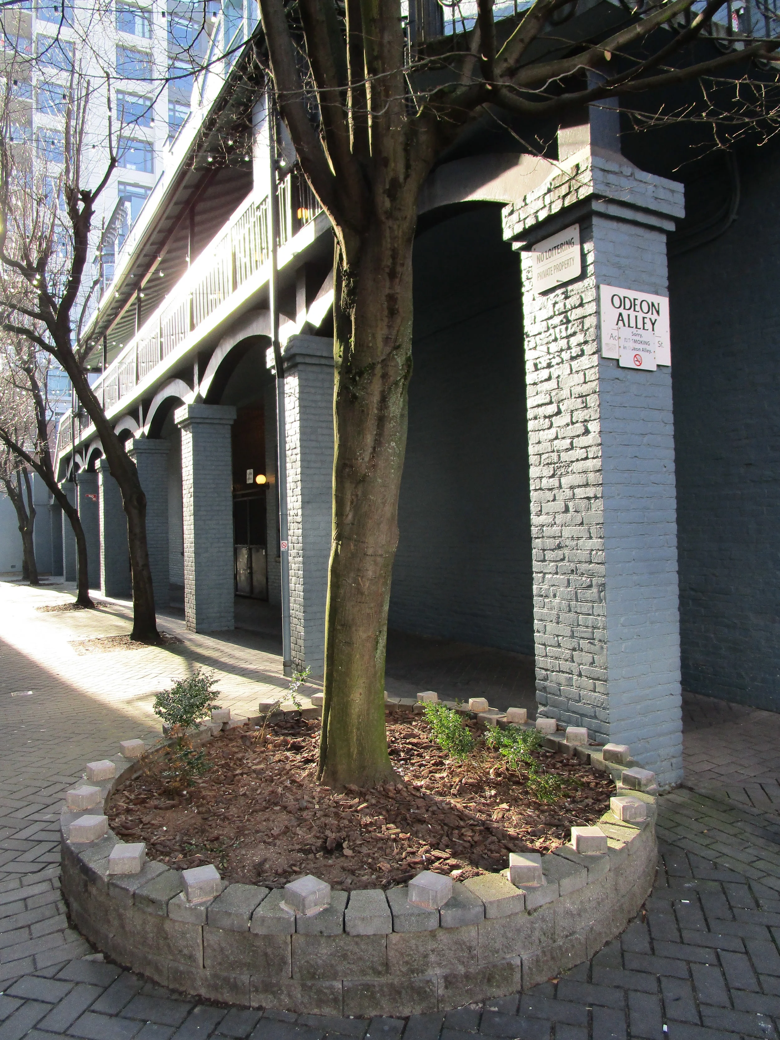
Different parts of Odeon Alley are owned by Cineplex Odeon, Concert Properties, and the City of Victoria.
Methods
A brief note on my methods, and my limitations. I started this project by looking for rights-of-ways. Because the city doesn’t have a master list, I checked every downtown parcel on the Land Title and Survey Authority (LTSA) website, looking for rights-of-way agreements in the “details” section of each parcel. MLA Carole James’s office graciously provided copies of the rights-of-way documents obtained through Legislative Library staff — my thanks to them both — which provided outlines for some of those spaces.
To flesh out my map, I used Victoria’s online mapping service, which includes easements and building outlines. Any remaining gaps I had to identify myself. There are no easements or rights-of-way in Trounce Alley, for example, so I used the LTSA’s website to may sure the properties were privately owned, and then traced the outline on my computer, using the city’s building outlines and aerial photos as a guide.
It’s likely I’ve missed lots of smaller things, such as privately-owned sidewalks, and maybe some bigger pieces as well. I’ve done my best to be as thorough as possible, and to adhere to the Guardian’s criteria for fake public space, but I acknowledge that the outlining process in particular was open to errors and personal interpretation. I had to ask myself, for example, up to what point might someone reasonably think they were on public property after entering the Empress Hotel’s footpaths and green space. I did my best, but I’m no cartographer. All the more reason for the city to use the resources at their disposal to document these things as accurately as possible.
If I’ve included spaces that are publicly owned, spaces that are not publicly accessible, or spaces that are fully covered, please report any mistakes here.